Kilvickadownig / Cill Mhic an Domhnaigh
Cross slabs and Clochaun
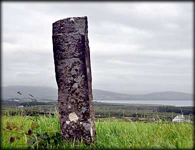
Situated below Mount Eagle and overlooking Dingle bay are the remains of an early Christian enclosure. They consist of an oval enclosure, known as a Calluragh burial ground, a Clochaun, a possible souterrain and two cross slabs. Also present is a stony ridge or leacht-known locally as Leacht Dháire or the the grave of Daire Donn. Kilvickadownig is a townland rich in historical and archaeological remains. A highly decorated triangular slab from kilvickadownig townland can be found at the Músaem Chorca Dhuibhne in Ballyferriter, that slab came from a ruined cashel about 0.5 kilometres south of the Calluragh. In the field below the enclosure stands one of several standing stones still remaining in the area. A superb rath can be viewed less than half a kilometre south south east of here on the R559. Opposite the Prehistoric Celtic Museum is Tobereendoney -Tobar Ri An Domhainaigh a badly neglected holy well.
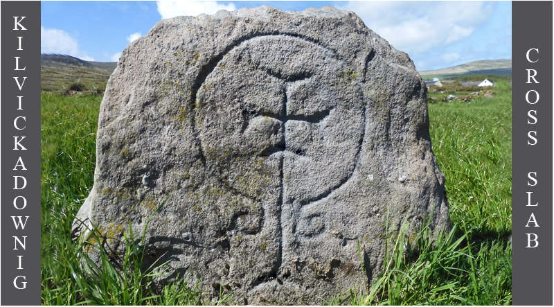
In a field directly southeast of the enclosure stands this stunning cross slab. The one metre high stone bears a beautiful Greek cross with expanded terminals. The cross is within a penannular circle, the ends of which are curved into a spiral. I wanted to visit this slab for many years, unfortunately it was quite dull during my visit, but luckily José managed to capture the carving in superb light on a previous visit. It is known locally as Leac na Ree, in Irish folklore it is said to mark the grave of Daire Donn "The King of the World" who was killed by Finn MacCool in the battle of Ventry.
The cross slab, pictured below, stands 1.25 metres high and is decorated on both sides. The west face bears a simple inscribed latin cross with another cross carved in relief above it. The second cross resembles a tau cross, but the top of that cross may have simply been worn away. The east face bears another incised latin cross.
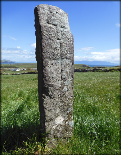
West face
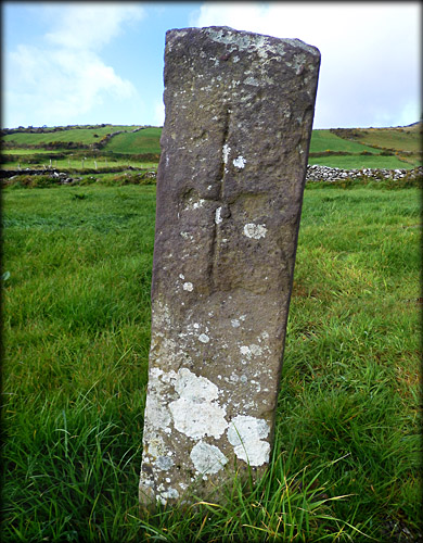
East face
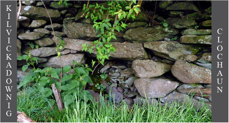
Almost hidden from view in the northwest corner of the field are the remains of a clochaun. Only the northwest side of it is present, it is located against the south east angle of a field wall and hidden beneath a tree. What looks like the entrance to a sweathouse is actually the inside of the lintelled doorway. You can just make out the curvature of the walls and roof. There are the scant remains of a least ten clochauns to the north of this enclosure.
Situated: The enclosure can be found on farmland belonging to Garvey's Farmhouse BnB. It is located on the R 559, opposite the Prehistoric Celtic Museum, about ten kilometres west of Dingle town.
Discovery Map 70: V 3576 9824. Last visit June 2021.
Longitude: 10° 23' 54.4 " W Cross slab, top image.
Latitude: 52° 06' 43.1" N
Photos: Jim Dempsey and José Gutiérrez.